Urbanism
14 posts tagged.
-

Satellite Lamps
Satellite Lamps is a project about making one of today’s most important infrastructures visible: GPS, the Global Positioning System. We built a series of lamps that change brightness according to the accuracy of the GPS signals they receive. Made with Einar Sneve Martinussen and Jørn Knutsen as part of the YOUrban research project at AHO.
-
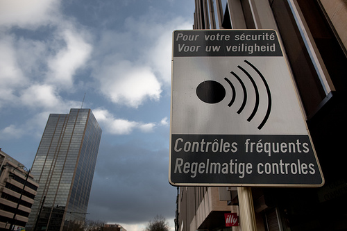
Pour votre sécurité
A single photograph of ‘Pour votre sécurité’ signage, dated 17 January 2010.
-
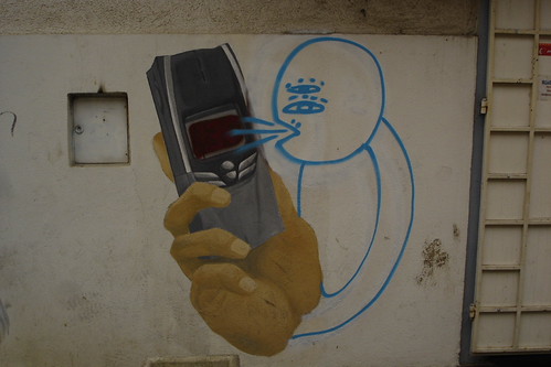
Graffiti as conversation
A short 2005 observation: photographing layers of conversation in graffiti, tagged ‘conversation’ on Flickr, prior art for thinking about spatial annotation on shared public surfaces.
-

Spatial memory at Design Engaged 2004
Presentation notes from Design Engaged 2004 in Amsterdam. Two related strands: the Time that land forgot project with Even Westvang (five months, 8000 photos, visualised by date and time of day), and the research on marking in urban public space.
-
Loop city workshop
Bill Hillier at University College London describes cities as movement economies, the structure of a city is the pattern of people moving through it. The workshop took this as the starting point and spent two days walking that idea across related fields: spatial organisation, relative space, time-space, taxicab geometry, mental mapping, text maps. Notes from the Loop City workshop at the Outside In symposium in Gothenburg, Sweden, June 2004. The workshop was led by Dietmar Offenhuber and Sara Hodges with participants from the symposium, working across geography, architecture, mapping and locative media. Raw notes below. spacesyntax.com Space explorers : children, homeless, vendors, skateboarders Space utilisers : commuters, workers Exocentric : external, connected Egocentric : centred, point of view Large, diverse research field Abler, Adams and Gould: Spatial Organization: The Geographer’s View of the World Expressing thematic data through spatial differentiation Political maps based on size of army Map of USA based on Elvis concerts Irina Vasiliev: Design Issues for Mapping Time Time as a way of measuring space (one conclusion: the world is shrinking) Grid systems make diagonal m…
-
Outside In
Outside In was a two-day forum at Röda Sten in Gothenburg on 14–15 June 2004, about new voices, media and practices in the design and use of public space. The venue is extraordinary: below a suspension bridge, surrounded by huge concrete creations. Really windy outside, calm inside the lecture space. These are my notes from the talks, written on the day. Occasional asides in italics are things I’ve added looking back. I’ve left the note form mostly as-is. (I missed the first workshop of the day.) Putting memories in spaces. Spaces aren’t the same after having been disrupted. After ‘Reclaim the Streets’ or a Circle Line party you can’t see the space in the same way. Distinction between public and private. What is it? Public space doesn’t exist anymore. Ken Livingstone’s new City Hall is half-private, half-public, private investment was involved in the building, so protests cannot happen outside. Do we need institutions in order to do events? Is that the only way to do them legally? What’s stopping people from doing these things is not necessarily capitalism but the fear of looking like a pillock. Self-regulation is a big factor. Can spark things to let down inhibitions or shackles. Example of the scooter, became a kids’ toy and then it wasn’t cool anymore.
-
Mobile social software applications
A list of mobile social software applications from 2004: Jabberwocky tracking familiar strangers, Fluidtime routing public transport in Turin, Dodgeball pinging your friends when they’re within ten blocks of you, Plazes tagging your location for the public, Mamjam chatting with others at the same venue by SMS. The first wave of location-aware social services, before smartphones. A growing list I compiled in June 2004 during early PhD research into mobile and locative systems. Descriptions below are taken from each project’s own site. Most of the projects are long gone; the list is preserved as a snapshot of what mobile social software looked like before the iPhone. Companion to the spatial annotation projects list . This research project explores our often ignored yet real relationships with Familiar Strangers. We describe several experiments and studies that lead to a design for a personal, body-worn, wireless device that extends the Familiar Stranger relationship while respecting the delicate, yet important, constraints of our feelings and relationships with strangers in pubic places. A visualization tool based on Mobster that enables users to explore their social encounters in new ways.
-

Spatial annotation projects
A reference list I compiled in June 2004 during early PhD research into locative media and spatial annotation. It includes Murmure in Vancouver’s Chinatown, Yellow Arrow stickers, Grafedia’s hyperlinked handwritten text, Urban Tapestries and dozens of others. The list is preserved as a snapshot of a field at a particular moment.
-
Public markup
Early PhD research into the marking of public space: the physical annotation of the city through stickering, graffiti and billboards. It looks for patterns in visibility, techniques, process, location, content and audience, and argues that the new short-range digital technologies, especially RFID, should be designed the same way. Not invisible.
-
Creative Crossings workshop
A triangular research network, practitioners from Britain, Canada and Finland, gathered in London to work on participatory and creative applications for mobile, locative and cross-platform media. Organised by m-cult, the Banff Centre and Arts Council England in April 2004.
-
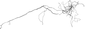
Urban GPS experience
Three months of trying to record a clean dataset of GPS tracks to geo-locate my photography, in Oslo and London. Notes on what the Garmin GPS Map 60c does and doesn’t do in dense European cities, from the pavement and from public transport.
-
Travelogue
A 2004 note on treating digital photography as a narrative medium, sequences of photos that suggest movement, place, stories and journeys. With plans to tag each image with a GPS coordinate so the sequence carries place as well as time.
-
Architecture theory books
This is one of a series of reading lists I put together between 2002 and 2004 when I was starting out in interaction and experience design, building out a personal canon from books I was buying, borrowing from libraries, or lending to students. The lists are grouped by topic. Architecture is the parent discipline of a lot of interaction design thinking, and this list is the shelf I was reading on the theory side: space, the city, urbanism, and the politics of the built environment. Calvino’s Invisible Cities is the book I keep giving to people. Bachelard’s Poetics of Space is the phenomenological counterpart, both are worth reading slowly. Bernard Tschumi’s Architecture and Disjunction and Manhattan Transcripts are the most polemical of the theoretical books. William J. Mitchell’s City of Bits and E-topia are the early digital-urbanism texts that most directly speak to interaction designers working on networked spaces. The Amazon links below are what I had at the time, most will be dead now, but the ISBNs will find you a copy. M. Christine Boyer. amazon.co.uk / amazon.com Nick Barley. amazon.co.uk / amazon.com Manuel Gausa. amazon.co.uk / amazon.com Norman Foster. amazon.co.uk / amazon.com
-
Mobile interaction design case study
A 2001 case study of consultancy work for Pollen Mobile, written up as it happened. Jack Schulze, Adi Nachman and I designed the interaction architecture for Mamjam, a location-based social entertainment service built on SMS, letting people in the same venue chat with each other by text.