Photo-research
9 posts tagged.
-
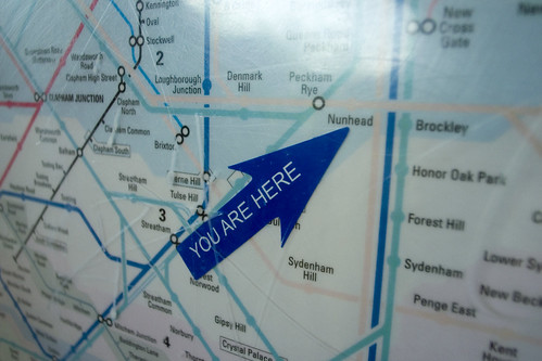
You are here
A 2006 note on collecting images of ‘you are here’ marks, or ideo locators, at Flickr. The relationship to local physical space is what makes them work: mapping with a point of view, maps as a direct interface to the world. The best example to date is from Seoul, where 3D cross sections of a metro station are directly related to the point at which you are looking at the map.
-
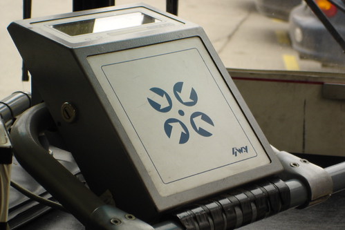
Photos of touch-based interfaces
A February 2005 note that became the start of a longer-running photographic project. In the way Victor Lombardi was collecting images of cardreaders, I was starting to collect images of touch-based interfaces like the Oyster card and other ‘touchable’ interfaces on public transport.
-
Spatial memory at Design Engaged 2004
Presentation notes from Design Engaged 2004 in Amsterdam. Two related strands: the Time that land forgot project with Even Westvang (five months, 8000 photos, visualised by date and time of day), and the research on marking in urban public space.
-
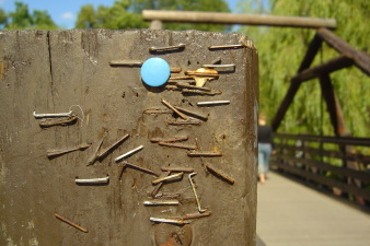
Public marking photographs
A short September 2004 pointer to a Flickr set of images of stickering, graffiti and flyposting , supporting material for the research into spatial annotation. There’s an ever-updated selection under the “ marking ” tag on Flickr. See the Design Engaged 2004 presentation for fuller context.
-
Time that land forgot
A 2004 project with Even Westvang from the Iceland inside-and-out workshop, a prototype for contextualising photographs by time and geography, designed to shift the balance of representation away from pure location and towards image and time.
-
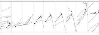
Photography and mapping from Afar
My contribution to ‘Afar’, an exhibition in Copenhagen where 25 international artists produced work to brief. For three months I recorded every walk, drive, train journey and flight I took while photographing daily life. Nine boards of images paired with GPS tracks drawn as simple lines show the transition from London to Oslo across a winter and spring.
-
Geo-referenced photography
The simplest way to link a photograph to a location is to combine two time-stamps: one from the digital camera, one from the GPS receiver. Given both sets of timestamps over the same period, a series of images and tracklogs can be processed to stamp each image with location metadata. Compiled in July 2004 at the Hofn workshop in Iceland, during the work that became Time that land forgot . A working reference list of papers, projects, guidelines, tools and the technical issues that surrounded geo-referenced photography at that moment. Most of the links below are now dead; the list is preserved as a snapshot of what the state of the art looked like in 2004. Position-annotated Photographs: The Geotemporal Web GEOREP: Digital Library for Spatial Data Geographic location tags on digital images, Microsoft Portable digital photo album Tokyo Picturesque ( details ) Habitat Perspectives Photo Location ( metadata notes ) Geo Snapper WWMX web demo Good list of other photo mapping projects Commercial applications and scripts that link photographs to geographic information: Robophoto 93 Photo Street Photofusion Media Mapper OziPhotoTool GPS photo link GPS TrackMaker QuakeMap WWMX Travelogue app…
-
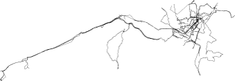
Urban GPS experience
Three months of trying to record a clean dataset of GPS tracks to geo-locate my photography, in Oslo and London. Notes on what the Garmin GPS Map 60c does and doesn’t do in dense European cities, from the pavement and from public transport.
-
Travelogue
A 2004 note on treating digital photography as a narrative medium, sequences of photos that suggest movement, place, stories and journeys. With plans to tag each image with a GPS coordinate so the sequence carries place as well as time.