Spatial annotation projects
A snapshot of the locative-media field in mid-2004. Murmure collecting stories in Vancouver’s Chinatown with telephone access at each location, Yellow Arrow putting physical stickers onto places as pointers to digital content, Grafedia hyperlinking handwritten text by email, Urban Tapestries mapping local knowledge onto the city of London.
A reference list I compiled in June 2004 during early PhD research into locative media and spatial annotation. Descriptions below are taken from each project’s own site; the list includes only projects that mark space, not mobile social software or dynamic gaming, not smart-mobs or friend-finders or GPS drawing projects, with a couple of exceptions for spatial platforms that attempt to standardise how we mark up space. Most of the project links below are now dead. The list is preserved here as a snapshot of a field at a particular moment. Thanks to physcomp, interactionfield and aware for inspiration.
Murmure
An archival audio project that has collected stories set in specific locations throughout Vancouver’s Chinatown. At each of these locations, a murmur sign marks the availability of a story with a telephone number and location code. By using a mobile phone, people can listen to the story of that place while engaging in the full physical experience of being there. Some stories suggest that the listener walk around, following a certain path through a place, while others allow a person to wander with both their feet and their gaze.
Area Code
Invites you to collect and reflect upon your immediate environment, and enables new forms of engagement and information exchange between person and place. Areacode aims to inspire comments about the affect of urban regeneration in the city.
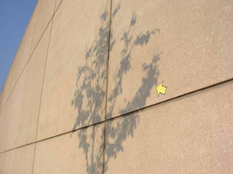
Yellow Arrow
A physical sticker allows people to mark places of interest, then tell a story about it using a photographic record.
Grafedia
Grafedia is hyperlinked text, written by hand onto physical surfaces and linking to rich media content – images, video, sound files, and so forth. It can be written anywhere – on walls, in the streets, or in bathroom stalls. Grafedia can also be written in letters or postcards, on the body as tattoos, or anywhere you feel like putting it. Viewers “click” on these grafedia hyperlinks with their cell phones by sending a message addressed to the word + “@grafedia.net” to get the content behind the link.
The Blue Plaque project
Collect all of the plaques in London, and then to put the people and events they commemorate in context – with their time, their contemporaries, and location.
Implementation
Implementation begins as sheets of stickers, with a different text on each sticker. We will distribute these sheets to individuals, both personally and via post. Instructions, asking people to peel the stickers off and place them in an area viewable by the public, will accompany the sheets.
Talking street
Using everyday technologies, like your own cell phone, Talking Street offers new ways to explore a destination. It’s having an ultra-savvy resident show you around — a guide who can reveal what a place is really like, and how it got that way.
The intelligent street
The intelligent street will enhance the experience of users in both locations by creating a gentle sonic playground that reflects the cultures of its users, entertain and act as a talking point. Users will be able to interract by sending SMS messages from their mobile phone. A display in each location and on the web will give optional information about how users are engaging.
Neighbornode
Group message boards on wireless nodes, placed in residential areas and open to the public. These nodes transmit signal for around 300 feet, so everyone within that range has access to the board and can read and post to it.
TAG: Scripting Presence
The inundation of consumer and mass media advertisements has eroded the presence of the individual within the city. In my thesis, I will explore how we can reclaim our physical landscape by reinserting the individual through visual representation into her/his urban environment. My intent is to create a momentary place to communicate messages of self-expression contributing to a network in which the next user can connect and experience.
R-Click
An area-information service from NTT DoCoMo incorporating mobile phones and a “wireless tag” device. A small, handheld RFID device will enable users to receive a wide variety of area information as they walk around the new metropolitan cultural complex of shops, restaurants, entertainment facilities, residences and hotels (Roppongi Hills).
Public Play Spaces
A platform for creative work exploring the playful, emotional and appropriate incorporation of technology into everyday public life. Drawing on our combined background in art, architecture, game and interaction design, the work focuses on developing both innovative design methods and experimental prototypes for social interventions in public space.
Trailblazer
A computer-mediated communication tool for supporting a virtual community. It attempts to integrate aspects of physical activity by community members in the real world into the virtual environment and to provide a structure for discourse around those activities.
34 North 118 West
Lets the user uncover samples of Los Angeles’s hidden history as s/he navigates through the multi-layered depths of downtown’s most poetic and surreal space. The result is a new kind of ‘scripted space’…
InterUrban
A user-driven experience that responds to participant’s amble through the city streets. Factors such as the distance traveled by the listener, time of day and proximity to fictive events, determine how the narrative unfolds.
Hidden natures
Location based narrative. Texts read by actors are the voices of the characters you hear as you walk through a space. A double headed arrow on the screen of your pocket computer (PDA) indicates the narrative direction – the future in one direction and the past another
Greyworld: Telescapes
Visitors discover a soundscape of messages left for them by both the artists and the public via voice and email. This interactive installation calls attention to how advances in cellular and wireless technologies contribute to the ubiquity of personal communications in public spaces, while illuminating the relationship between the built environment and the invisible networks that make these fleeting exchanges possible.
Geoloqus
Geoloq.us is a service that lets users leave behind memories, comments and digital artefacts in a physical location, for others to discover and enjoy. A cameraphone with a web browser is all you need to use geoloq.us; browse pictures from the place you’re at, comment a location or a picture and find out what’s nearby. Tag your items and surf those tags for similar items from other people in other places.
GeoNotes
Based on positioning technology, allows people to attach virtual notes to real world locations. When other people pass the location, they will be notified about the note and will be able to read it. GeoNotes allows mass-annotations with no or little restrictions on accessing others’ GeoNotes. It is also social in the way it incorporates social filtering techniques to sort out unwanted GeoNotes.
GeoStickies
An interactive public art project that enables us to make and access to collective of personal memory that could have been overlaid on to urban space. The project puts some “tags” of small events onto geographical fields so that the audience can feel correspondence between “Information space” and “Urban space”. The audience will find tiny electronic memorials for tiny events. But those are only visible or able to be experienced through mobile phones.
GeoGraffiti
To demonstrate the concept of waypoint sharing we have been developing a number of waypoint sharing applications. These applications access the waypoint lists for retrieval and storage of waypoint data and other accessory information, such as text, images, audio, video, or links to other information.
<a href="http://www.pcworld.com/news/article/0,aid,119598,00.asp">Digital Graffiti (Siemens)</a>
The application allows mobile phone owners to send a message, similar to an SMS (Short Message Service), to a geographical point where it appears on the screens of other users passing through the defined location. Unlike an SMS, the message is not sent to a person but rather to a location, and can be received by a number of mobile phone users entering the defined radius.
Ambient Wood
An outdoor playful learning experience. Pervasive technologies are used to digitally augment a woodland in a contextually relevant way, enhancing the ?usual? physical experience available to children exploring the outdoor world. Studies show this to be a highly engaging novel experience for learners, that effectively supports collaborative learning, as well as providing preliminary guidelines for designing different ways of delivering digital information for learning.
Thingster
Lets you publish information about places. You can use thingster to discover things in your own neighborhood that might be interesting to you – and you can use thingster to publish information about things that you find interesting. Thingster also provides signalling and discovery services for discovering other nearby folks with interests similar to your own.
World-Wide Media eXchange
The project explores possibilities with digital photographs and geographic location. The location where a photo was taken provides clues about its semantic context and offers an intuitive way to index it, even in a very large collection. The combination is powerful, but still not supported well by either the photo-software or camera-hardware industries.
Mobile Media Metadata
Leverages the spatio-temporal context and social community of media capture to infer media content.
Altavistas
An experimental project to explore how physical and electronic spaces can be designed in conjunction with each other to provide new kinds of experience in the city.
mStory
A mobile mapping and recording system built for the PocketPC platform. It integrates GPS tracking technology with a set of diary-like recording features. mStory assign a variety of attributes to recorded locations, including photos, audio recordings, narrative descriptions and icons.
Katumuisti tositarinoita Helsingista [Street memories]
Personal local stories for public listening using mobile phones & billboard notices.
Interactive portrait of the Liberties
An interactive digital narrative application providing multimedia content to individuals and to groups, which is relevant to them at a particular point in time and space.
Section
A database video project, currently under development, that examines the embedded syntax of our routes through the city and challenges the mediated experiences of the urban environment through methods of collecting, editing and compositing video.
TRACE
A memorial environmental sound installation that is site-specific to the network of hiking trails near the Burgess Shale fossil beds in Yoho National Park, British Columbia.
Map Hub
MapHub is a web-based, multi-user, group managed information storage system and map. Collecting information about people, places, events, and notes, can help to document unseen narratives and histories in public or private theme-based Hubs.
Community Mapbuilder
Offers a range of resources to help organizations get started with standards-based online mapping. The main initial focus is creating an open source framework to allow communities to jointly build geographic databases and share them over the web.
Annotated multimedia Google map
This how-to will show you how to make your own annotated Google map from your own GPS data. Plus, you’ll be able to tie in images and video to create an interactive multimedia map.
City of memory
A narrative map of New York City that allows visitors to create a collective memory by submitting stories. Visitors link stories together by theme, creating new “neighborhoods” of narrative that can be explored by others. Stories can be recommended, giving new visitors a sense of the narrative created by the populace.
TeleTaxi
A site-specific media art exhibition in a taxicab. The taxi is outfitted with an interactive touch screen that displays video, animations, music, and information triggered by an onboard GPS(Global Positioning System) receiver which allows the displayed artwork to change depending on where the taxi is in the city.
New York Songlines
By relying on maps, signs and Manhattan’s perpendicular geography, New Yorkers have given up something important: a sense of place. If you can get from your starting place to your destination without knowing anything about the points in between, chances are you won’t pay much attention to them.
Touch Tone Tours
Delivers tour guides of popular landmarks, museums, attractions and the unusual to wireless devices. More info.
Soundwalk
Sound recordings as guides to specific locations. Available as audio for sale or as downloaded format from Audible or iTunes.
Tag
A street activity proposed for the site of Times Square, NYC. Employing mobile phone text messaging, it focuses on increasing personal contribution and interaction to the experience of this public space. Individuals will participate with one another as they tag designated areas or ?nodes?? by displaying their inscription.
Mogi
A collecting game ‘item hunt’. The game provides a data-layer over the city of Tokyo. As you move through the city, if you check a map on your mobile phone screen, you’ll see nearby items you can pick up and nearby players you can meet or trade with.
ASAP: another spatial annotation project
Allows you to visualize your location on a map, use a GPS unit (I use a GPS-based GPS device) to mark your coordinates (or just navigate the map to find your location – especially useful in cavernous cities like Manhattan), annotate that location by titling it and giving it a description, optionally adding an icon or snapping a digital picture with the attached camera.
Urban Tapestries
A research project exploring social and cultural uses of the convergence of place and mobile technologies.
HyConExplorer
HyCon is a framework and infrastructure for context aware hypermedia systems developed primarily by the hypermedia group at the University of Aarhus, Denmark. The HyCon framework encompasses annotations, links, and guided tours associating locations and RFID- or Bluetooth-tagged objects with maps, Web pages, and collections of resources. The HyCon architecture extends upon earlier location based hypermedia systems by supporting authoring in the field and by providing access to browsing and searching information through a novel geo-based search (GBS) interface for the Web.
Herecast
Provides location-based services on a WiFi device. At its simplest level, it can tell you where you are. More advanced services can use your location to enhance information lookups, publish presence information and create games.
Texting Glances
This ambient “waiting” game establishes a symbiotic relationship between a transient audience, a waiting place, and a story engine that matches SMS inputs to image output. By incorporating culturally current messaging norms, the audience becomes an active collaborating author in a layered exploration of social familiarity and public space.
Public alley 818
Creating and performing artworks in a public alley in Boston, MA, with work selected by participants in the space and online.
One block radius
Psychogeographic survey of one block in New York, building a multi-layered portrait of a particular part of the city.
Annotate space
A project to develop experiential forms of journalism and nonfiction storytelling for use at specific locations. Stories are presented through text, images and audio files that participants can download from the Web to their handheld computers and take with them to the place of interest.
Annotated Earth
The goal of AnnotatedEarth is to create a user-driven community of quality location and spatial information, a infrastructure for accessing that information, and software that uses that information to provide location-aware information.
Embedded Theatre
A system for creating immersive narrative experiences where location is an actor. It is the result of an intensive research and design project addressing how interactive narrative can be successfully realized through mobile technology.
Tag and Scan
London-based locational application and service for mobile telephones. The technology allows users to “tag” a physical locations, placing them into meaningful context. Tags can be private or public. Other TagandScan users can scan their environment for public tags left by others. TagandScan essentially enables the community to annotate its physical features.
Spotcode
Each Spot is a circular symbol that holds data like a two dimensional bar code. Users of the latest camera phones point their phone at the Bango Spot circular symbol, click and the mobile site opens on their phone in a matter of seconds.
PDPal
A mapping application that transforms everyday activities and urban experiences into a dynamic city that you write. Engages the user through a visual transformation that is meant to highlight the way technologies that locate and orient are often static and without reference to the lively nature of urban cultural environments.
AmbieSense
Context-sensitive technology based on the use of context tags. These small electronic tags are a means of capturing and communicating information about the surroundings.
Hypertag
A commercial service allowing access to info and content on a mobile phone directly from objects like adverts and signs. It works by allowing infra-red mobile phones, and PDAs (e.g. Palm Pilots or Pocket PCs) to interact with a small electronic tag which is attached to the advert or sign.
Pathalog
Exploring the ability of a path-based publishing system, based upon GPS tracking technologies, to foster new relationships between communities of users and their environments.
Waveblog / Wavemarket
Three commercial platforms for location based services. You can add information and commentary about restaurant reviews to safety tips. Waveblog lets users upload blog-like information with geographic metadata.
Rabble
Rabble enables a new kind of self-expression that informs, entertains and connects people through the media they create. Create your channel and post location-based media – your favorite places, photos or an up-to-the-minute newsworthy event. It’s like putting virtual sticky notes on the world around you.
Earthcomber
Lets you connect with customers in a timely, efficient and positive way. By providing a direct match between a user’s favorite and something you offer, Earthcomber brings you to the customer’s attention. In multiple information screens, they can see what you offer and where you are on the map.
Timespots
Offers ‘location-based services’ on mobile devices (PocketPC/phones) enabling new uses of traditional travel and tourism services. We overcome current limitations (in reach of and access to information and services) by combining information and navigation services with communication services on one device.
Websigns
HP research labs. Using a handheld computer, cellular phone or other device, users can get information on the Web related to physical structures and objects in the immediate vicinity.
Microsoft Aura
The Advanced User Resource Annotation system (A.U.R.A.) is designed to provide the ability to access and author annotations on objects and places using machine readable tags. In our system, a user can associate text, threaded conversations, audio, images, video or other data with specific tags. Users can also review the tags and descriptions of the objects they have encountered and annotated in a custom web portal.
Active Campus
Community-oriented ubiquitous computing, exploring the problem and opportunity of sustaining community through mobile wireless technology. The two principal applications in operation are: ActiveCampus Explorer, which uses students’ locations to help engage them in campus life; and ActiveClass, a client-server application for enhancing participation in the classroom setting via small mobile wireless devices.
Mobile Augmented Reality Systems
Exploring the synergy of two promising fields of user interface research: Augmented reality, in which 3D displays are used to overlay a synthesized world on top of the real world, and mobile computing, in which increasingly small and inexpensive computing devices, linked by wireless networks, allow us to use computing facilities while roaming the real world.
Living Memory LiMe
A network of augmented places within the local community which support the creation and meaningful distribution of informal content within that community. LiMe provides low-threshold interfaces in natural meeting and crossing points within that community, such as cafés and bus stops.
Location linked information
LLI is similar to augmented reality systems which overlay digital information on top of the physical world. Whereas augmented reality systems typically concentrate on solving the user interface problem, LLI attempts to solve the data access and search infrastructure issues. In LLI users navigate the physical world with a variety of XML-speaking devices, discovering and leaving “handles” to information nuggets.
MUD London
A kind of collaborative mapping project. it consists of geographical models which are represented as RDF graphs. you can wander round them, like a MUD or MOO, with a bot interface which you can use to create and connect new places.
Psychogeographical Markup Language
A protocol that can be used to capture meaningful psychogeographical data about urban space. PML is a unified system of classification that lurks behind the psychogeogram: the diagrammatic representation of psychogeographically experienced space.
Spatial Annotation with Locative Packets
An attempt to fuse powerful concepts of existential declaration (I am here experiencing this!) with networked social communication media. By mixing together a set of terms about space, time, description, social relationship, and media, the locative packet project has described a unique ether over which one form of collaborative map can travel.
Wooster Collective
Huge archive of street artists work, techniques, interviews, and guides.
Here I am only including projects that mark space, not mobile social software or dynamic gaming, smart-mobs, friend-finders or GPS drawing projects, although I have included a couple of spatial platforms, that aim to standardise the way we mark-up space.